Wyoming trails · Divide
Divide
A 19.7-mile out-and-back in Wyoming, with 2,484 ft of climbing. Reaches Observation Peak and other pass/summit destinations. Managed by USFS 041554.
Elevation profile
Most of the climbing sits in the middle third — 66% of the ascent, between mile 6.6 and mile 13.1. It gives back about 4,833 ft along the way, so it rolls rather than climbing steadily.
3-D terrain
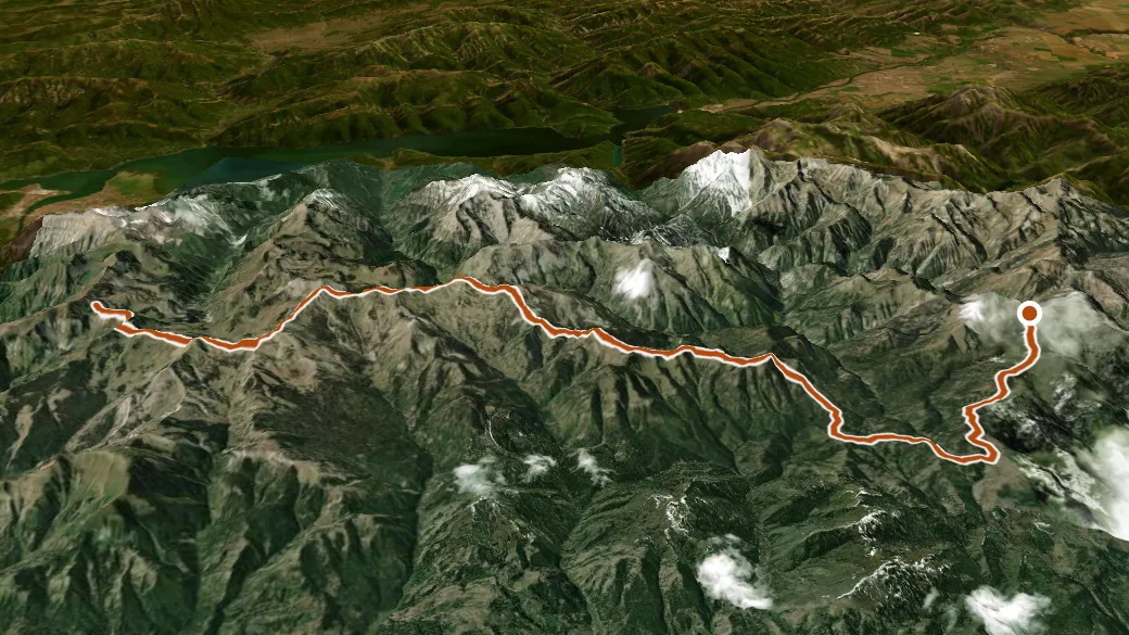
USGS 3DEP ELEVATION × ESRI WORLD IMAGERY · VERTICAL ×1.5
Reaches
- Observation Peak (summit)
- North Indian Creek Pass (pass)
- Mud Pass (pass)
Heads up
Getting there
INDIAN PEAK access. 43.27722, -110.93415 · directions
Daylight at the trailhead
On August 31, 2026 — the day this page was generated — first light reaches this trailhead at 6:17 a.m., the sun rises at 6:46 a.m. and sets at 8:00 p.m., and the last usable light fades about 8:30 p.m. (MDT) — 13 h 14 min of daylight. At about 2.7 mph plus 30 minutes per 1,000 feet of climbing, the 39.4-mile round trip works out to roughly 17 h 05 min of walking — more than a single day of daylight here, so plan it as an overnight or hike it in sections.
Loop options
- NORTH INDIAN PASS + SOUTH FORK ELK CREEK + DIVIDE — 7.7 mi loop, 3,288 ft gain
- SOUTH FORK ELK CREEK + DIVIDE + CODY MOUNTAIN — 16.3 mi loop, 4,417 ft gain
- SOUTH FORK INDIAN CREEK + OBSERVATION PEAK + DIVIDE — 5.9 mi loop, 2,300 ft gain
Nearby trails
- Divide Trail — 14.5 mi
- Granite Creek — 25.5 mi
- Teton Crest South — 28.1 mi