Kentucky trails · Lakeview Ridge
Lakeview Ridge
A 2.4-mile network in Kentucky, with 469 ft of climbing. Reaches Giant Canada Goose Pond and other lake/viewpoint destinations. Managed by the U.S. Forest Service.
Elevation profile
Most of the climbing sits in the middle third — 57% of the ascent, between mile 0.8 and mile 1.6.
3-D terrain
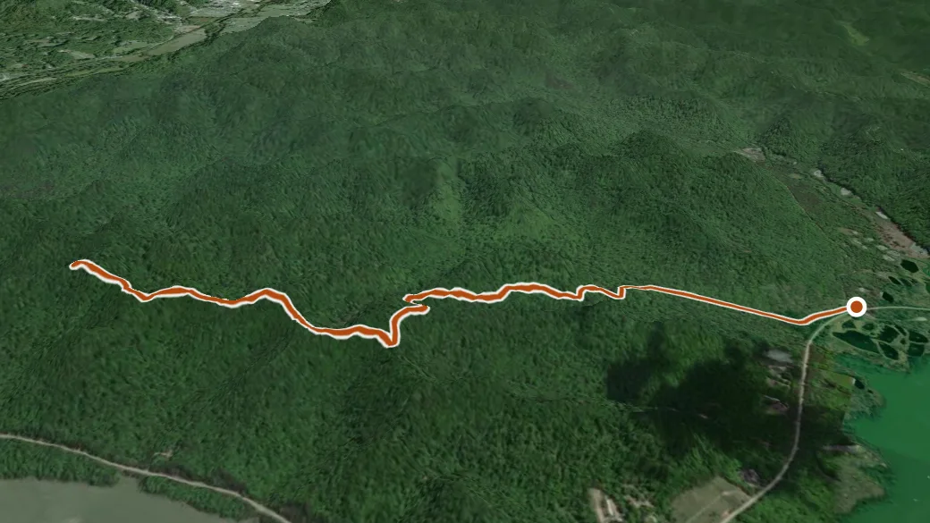
USGS 3DEP ELEVATION × ESRI WORLD IMAGERY · VERTICAL ×1.5
Reaches
- Giant Canada Goose Pond (lake)
- Shallow Flats Wildlife Viewing Area (viewpoint)
Heads up
Getting there
Lakeview Ridge access — parking nearby. 38.10123, -83.49256 · directions
Daylight at the trailhead
On August 31, 2026 — the day this page was generated — first light reaches this trailhead at 6:35 a.m., the sun rises at 7:02 a.m. and sets at 8:05 p.m., and the last usable light fades about 8:32 p.m. (EDT) — 13 h 03 min of daylight. At about 2.7 mph plus 30 minutes per 1,000 feet of climbing, the 2.4-mile route takes roughly 1 h 06 min, so leaving the trailhead at sunrise puts you back around 8:08 a.m. — 11 h 57 min before sunset.
Nearby trails
- Buckskin — 2.4 mi
- Red River — 19.8 mi
- Osborne Bend Loop — 19.8 mi
- Douglas Trail — 19.8 mi